GIS Services

GIS services involve the use of computer systems to capture, store, analyze, and visualise geospatial data.

We have provided GIS Services successfully to global electricity, gas, water, telco and defence organisations for 30 years.  These services included Consulting, Upgrades, Spatial Analytics, Maintenance, Support, Training, as well as ERP, EAM, ADMS, HERE and Field-to-Office Integrations.

Here is the typical Persona we service at global Utilities and Telcos:

Demographics

– Age: 42
– Gender: any
– Occupation: GIS Manager at a Utility Company
– Education: Master’s Degree in Geographic Information Systems (GIS)

Goals

– Implement and maintain efficient GIS systems to support utility operations
– Enhance data accuracy and accessibility for better decision-making
– Promote the integration of GIS technology across various departments

Pain Points

– Managing large volumes of geospatial data
– Ensuring data integrity and accuracy
– Keeping up with rapidly evolving GIS technologies

Behaviors

– Regularly collaborates with IT and other departments to integrate GIS solutions
– Attends industry conferences and workshops to stay updated on GIS trends
– Utilizes advanced GIS software for data analysis and visualization

Motivations

– Passion for geospatial technology and its applications
– Desire to improve operational efficiency and service delivery
– Commitment to environmental sustainability through better resource management

Preferences

– User-friendly GIS software with robust analytical capabilities
– Access to continuous professional development opportunities
– Clear communication and support from upper management

Responsibilities

– Oversee the development, implementation, and maintenance of GIS databases and applications
– Coordinate the collection, analysis, and dissemination of geospatial data
– Lead GIS project planning, including defining scope, objectives, and timelines
– Develop and enforce GIS data management policies and standards
– Advocate for the use of GIS technology in decision-making processes.

We have created nfoldROI for these persona and earned their repeat and referral business for 30 years.

SHARE THIS

Explore our GIS Services

nfoldROI Data Entry

GIS Training

We offer a wide range of training, from beginner to advanced levels, covering various aspects of GIS technology.
nfoldROI GIS Support

GIS Support

Quality and comprehensive GIS support is vital to maintain an effective business system.
nfoldROI GIS Maintenance

GIS Maintenance

Maintaining a GIS is essential for ensuring its reliability and effectiveness.
nfoldROI GIS Spatial Analysis

GIS Spatial Analytics

Spatial analytics is a field that examines locations, attributes, and relationships of features in spatial data through various analytical techniques and tools.
nfoldROI GIS Integration

GIS Integration

GIS integration involves connecting various IT systems, software, and technologies.
service1.jpg

GIS Upgrades

Upgrading your GIS
nfoldROI GIS Consulting

GIS Consulting

GIS consulting involves expert advice and services.

Products we use for GIS Services

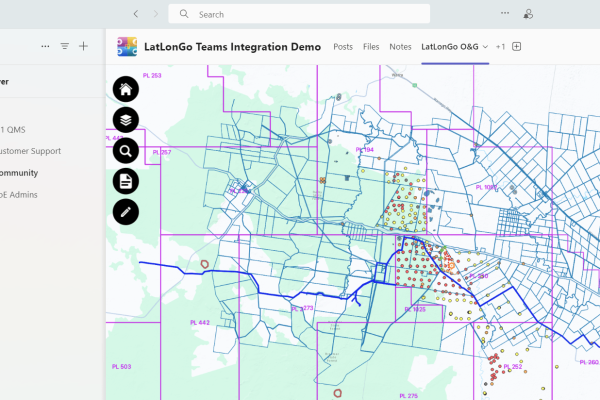
LatLonGo Microsoft Power Platform Teams

LatLonGo Microsoft Power Platform

LatLonGo for the Power Platform extends the functionality of our successful LatLonGo Native product.
nfoldROI GIS Conflation

adjust.IT Esri Utility Network Model

The ESRI Utility Network Model (UNM) – a comprehensive utility and telco framework.
nfoldROI GIS Conflation

adjust.IT Esri ArcGIS Online

ArcGIS Online, a cloud-based mapping platform.
nfoldROI GIS Conflation

adjust.IT Esri ArcMap

ArcMap will retire on March 1, 2026 presenting an exciting opportunity for adjust.IT ArcGIS Pro.
nfoldROI GIS Conflation

adjust.IT Esri ArcGIS Pro

ArcGIS Pro is a powerful desktop GIS software developed by Esri allowing users to visualise and analyse data in both 2D and 3D.
nfoldROI GIS Conflation

adjust.IT GE Smallworld GIS

GE Smallworld GIS, a cutting-edge geospatial information system.
nfoldROI GIS Conflation

adjust.IT Methodology

GIS conflation is the process of combining multiple geospatial datasets to create a more accurate and comprehensive dataset. adjust.IT is the #1 Conflation Methodology researched since 1982, commercially released 2000, AI version patent pending.
nfoldROI GIS/ERP Integration

GIS|Connect

GIS|connect – World first SAP Certified interface at United Energy in 1996, still in production today.