LatLonGo Microsoft Power Platform

LatLonGo for the Power Platform extends the functionality of our successful LatLonGo Native product.

The Microsoft Power Platform is a comprehensive suite of tools designed to empower users of all technical levels to analyze data, build solutions, automate processes, and create virtual agents. It’s a low-code platform that enables rapid development of end-to-end business solutions, making it accessible and user-friendly for all.

LatLonGO is seamlessly integrated with the Microsoft Power Platform, significantly enhancing its capabilities. This integration allows users to overlay electricity, gas, water, or telecom networks with valuable infrastructure assets. It turns ideas into solutions by enabling the creation of custom apps that solve business challenges, making disparate data sources navigable and searchable.
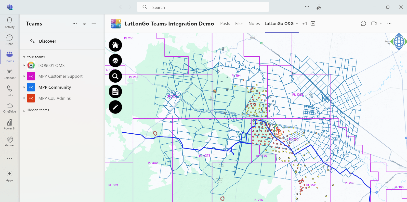
LatLonGo Microsoft Power Platform Teams
#image_title

For organizations looking to distribute GIS data to field workers efficiently and securely, LatLonGO offers a robust solution that aligns with modern mobility and enterprise resource planning strategies.

Overlaying your electricity, gas, water or telco linear networks makes your valuable infrastructure assets searchable and navigable.  Turning ideas into solutions enables you to build custom apps that solve business challenges by integrating GIS agnostic LatLonGo network data with Power Apps.

Integrating Power forms with LatLonGo allows you to associate assets or locations in the field with office data.  With model-driven Power Apps, forms provide you with the interface you need to interact with your valuable business data to do your work.


SHARE THIS

Services using LatLonGo Microsoft Power Platform

nfoldROI GIS Services

GIS Services

GIS services involve the use of computer systems to capture, store, analyze, and visualise geospatial data.
nfoldROI Data Entry

GIS Training

We offer a wide range of training, from beginner to advanced levels, covering various aspects of GIS technology.
nfoldROI GIS Support

GIS Support

Quality and comprehensive GIS support is vital to maintain an effective business system.
nfoldROI GIS Maintenance

GIS Maintenance

Maintaining a GIS is essential for ensuring its reliability and effectiveness.
nfoldROI GIS/Field to Office Integration

GIS/Field to Office Integration

Field-to-office integration ensures seamless operations and efficient information flow between on-site activities and back-office management.
nfoldROI GIS/HERE Integration

GIS/HERE Integration

HERE Maps, now known as HERE WeGo, is a web mapping and navigation service operated by HERE Technologies.
nfoldROI GIS/EAM Integration

GIS/EAM Integration

GIS and EAM (Enterprise Asset Management) integration is a strategic approach that combines geospatial data and asset management processes.
nfoldROI GIS/ERP Integration

GIS/ERP Integration

Integration of GIS with ERP (Enterprise Resource Planning) integration is a process that combines the geospatial capabilities of GIS software with the comprehensive data management and analytics of ERP systems.
nfoldROI GIS Consulting

GIS Consulting

GIS consulting involves expert advice and services.