adjust.IT GE Smallworld GIS

GE Smallworld GIS, a cutting-edge geospatial information system.

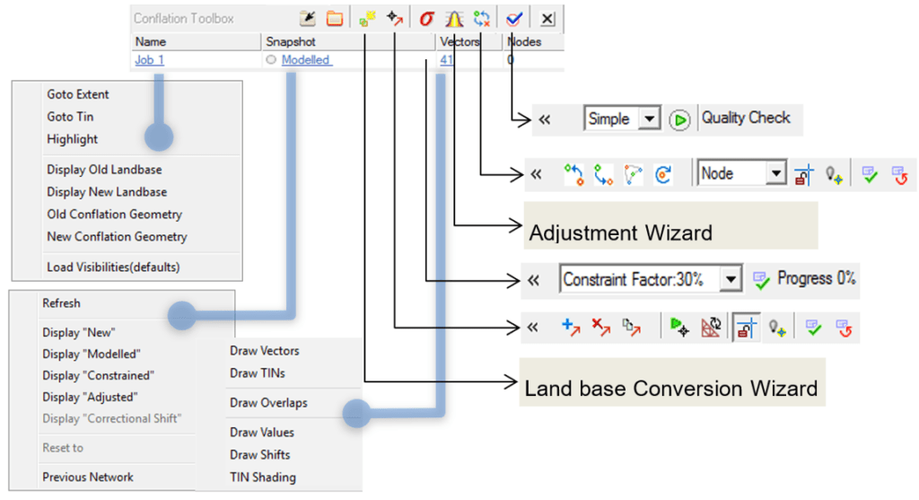
What sets Smallworld GIS apart is its ability to go beyond traditional GIS capabilities, offering unique solutions for network-based modelling, data workflow management, and infrastructure challenges throughout the entire network asset lifecycle.

Smallworld GIS is not just a robust solution but also a cost-effective one.  Moreover, the system helps optimise new build plans, considering various planning and design alternatives, potentially reducing new build costs. 

Smallworld GIS is highly scalable and supports various industry-focused products for different utility sectors. It’s also integrated with multiple tools for geospatial business intelligence, web mapping, mobile enterprise solutions, and more.

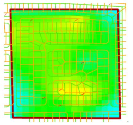
Typical shift “heat map”.

Our adjust.IT Smallworld GIS software has been successfully used by many global utility/Telco companies, such as AltaGas, APA Group, Atmos Energy, Ausgrid, CableVision Altice, Chorus, Deutsche Telekom, Duke Energy, Ergon Energy, Essential Energy, Fortis BC, Gaz Réseau Distribution France, Helix Water, Manitoba Hydro, Piedmont Natural Gas, Water Corporation of WA, and Xcel Energy.


SHARE THIS

Services using adjust.IT GE Smallworld GIS

nfoldROI GIS Services

GIS Services

GIS services involve the use of computer systems to capture, store, analyze, and visualise geospatial data.
nfoldROI Data Entry

GIS Training

We offer a wide range of training, from beginner to advanced levels, covering various aspects of GIS technology.
nfoldROI GIS Support

GIS Support

Quality and comprehensive GIS support is vital to maintain an effective business system.
nfoldROI GIS Maintenance

GIS Maintenance

Maintaining a GIS is essential for ensuring its reliability and effectiveness.
nfoldROI GIS Conflation

Conflation Services

Conflation meticulously combines spatial data from multiple sources, such as a legacy land base related to utility networks and highly accurate LIDAR, Digital Imagery, GPS or Terrestrial Surveys.
nfoldROI GIS/ADMS Integration

ADMS Data Readiness

ADMS data readiness prepares your organisation’s data and business processes.
Global Right shoring

Right-Shoring

Right shoring services involve strategically placing a business’s operations in locations that offer the best balance of cost, efficiency, and quality.
nfoldROI GIS Consulting

GIS Consulting

GIS consulting involves expert advice and services.