Digital Twins for Local Government

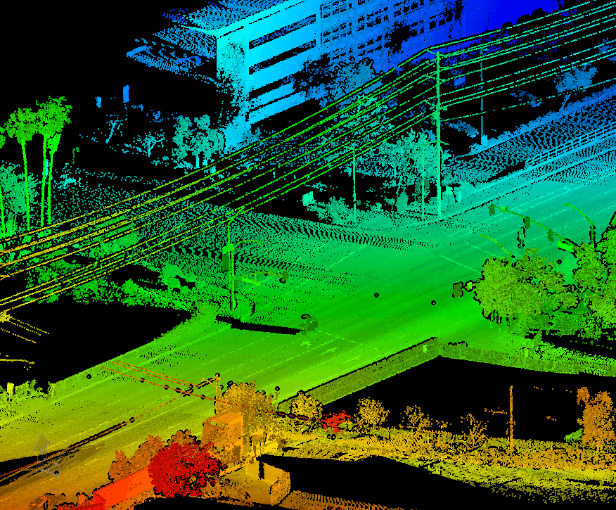
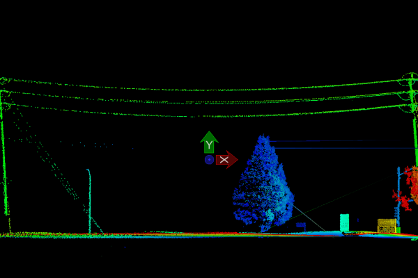
By leveraging LIDAR technology, Local Government can make more informed, data-driven decisions across multiple domains, ultimately improving urban planning, infrastructure management, and residents' quality of life while saving 80% of their Inspection travel costs.

Digital Twins in Local Government: A Cost-Benefit Analysis

Local governments face increasing pressure to optimize operations, reduce costs, and improve service delivery while managing limited budgets. 

This page demonstrates how Light Detection and Ranging (LIDAR) technology offers a compelling return on investment for municipalities and counties through improved efficiency, reduced operational costs, and enhanced revenue generation opportunities.

Our analysis shows that LIDAR implementation typically delivers 150-200% ROI within three years (and much earlier using a Solution as a Service Subscription) while significantly improving public service delivery and safety.

The Financial Challenge for Local Governments

Current Operational Inefficiencies

  • Manual infrastructure inspection costs: $500,000-$1M annually for medium-sized municipalities
  • Emergency repair expenses: 40% higher than planned maintenance
  • Resource allocation inefficiencies: 25-30% of staff time spent on avoidable tasks
  • Revenue leakage from outdated property assessments: 5-15% of potential tax revenue

Rising Costs and Budget Constraints

  • Infrastructure maintenance backlog growing at 7% annually
  • Emergency response costs increasing 5% year-over-year
  • Staffing costs rising while budgets remain static
  • Increasing public demand for improved services

LIDAR Solution: Investment and Returns

Initial Investment Components

  1. Hardware Infrastructure
    • Fixed LIDAR units: $50,000-$150,000 per unit
    • Mobile LIDAR systems: $200,000-$400,000 per vehicle
    • Data processing infrastructure: $100,000-$300,000

These costs can be eliminated by using our nfoldROI-4D Digital Twin as a Service (DTaaS)

  • Software and Integration
    1. Enterprise software licenses: $150,000-$300,000
    2. System integration: $200,000-$400,000
    3. Training and implementation: $100,000-$200,000
  • Ongoing Operational Costs
    1. Annual maintenance: 10-15% of hardware costs
    2. Software updates and licensing: $50,000-$100,000 annually
    3. Staff training: $25,000-$50,000 annually

These costs can be eliminated by using our nfoldROI-4D Digital Twin as a Service (DTaaS)

Direct Revenue Generation

Property Tax Assessment
  • Improved accuracy in property measurements
  • Detection of unreported improvements
  • Average revenue increase: 3-7% of current property tax base
  • Case Study: Montgomery County, MD
  • Investment: $500,000 in LIDAR scanning
  • Additional revenue identified: $2.1M in the first year
  • ROI: 420% in year one
Permit and Fee Collection
  • Automated detection of unpermitted construction
  • More accurate fee assessments
  • Revenue increase: 10-15% in related permits and fees
  • Case Study: Austin, TX
  • Investment: $750,000 in LIDAR system
  • Additional permit revenue: $1.2M annually
  • ROI: 160% annually

Cost Reduction and Efficiency

Infrastructure Maintenance
  • 25-35% reduction in inspection costs
  • 40% reduction in emergency repair expenses
  • Extended infrastructure lifespan through predictive maintenance
  • Case Study: Seattle, WA
  • Annual maintenance budget: $12M
  • Cost reduction: $3.6M (30%)
  • Additional savings from prevented failures: $2.1M
Operational Efficiency
  • 30% reduction in field survey time
  • 40% decrease in project planning duration
  • 25% improvement in resource allocation
  • Case Study: Denver, CO
  • Staff time savings: 12,000 hours annually
  • Equivalent cost savings: $720,000
  • Project acceleration savings: $1.1M

Risk Mitigation and Savings

  • 45% reduction in liability claims
  • 30% decrease in emergency response costs
  • 25% reduction in insurance premiums
  • Annual savings: $500,000-$1.5M for medium-sized municipalities

Implementation Strategy and ROI Timeline

Year 1: Foundation and Initial Returns

  • Returns:
    • Property tax revenue increase: $500,000-$1M
    • Permit revenue increase: $200,000-$400,000
    • Operational savings: $300,000-$500,000
    • Net ROI: 0-25%

Year 2: Optimization and Growth

  • Additional Investment: $500,000-$750,000 – Included in our nfoldROI-4D Digital Twin as a Service (DTaaS)
  • Returns:
    • Property tax revenue increase: $1M-$1.5M
    • Permit revenue increase: $400,000-$600,000
    • Operational savings: $750,000-$1M
    • Cumulative ROI: 50-75%

Year 3: Full Implementation Benefits

  • Returns:
    • Property tax revenue increase: $1.5M-$2M
    • Permit revenue increase: $600,000-$800,000
    • Operational savings: $1M-$1.5M
    • Cumulative ROI: 150-200%

Financing Options

Traditional Funding

  • Capital improvement bonds
  • General fund allocation
  • Federal and state grants
  • Technology modernization funds

Alternative Financing

  • Public-private partnerships
  • Revenue-sharing agreements
  • Performance-based contracts
  • Equipment leasing

Grant Opportunities

Smart City initiative funding

  • Infrastructure modernization grants
  • Climate resilience grants
  • Digital transformation programs

Risk Management and Mitigation

Implementation Risks

  • Technology adoption challenges
  • Data management complexity
  • Staff resistance
  • Integration with legacy systems

Mitigation Strategies

  • Phased implementation approach
  • Comprehensive training programs
  • Clear change management process
  • Regular stakeholder communication

Recommendations for Local Government Leaders

  1. Start with High-Impact Areas
    1. Begin with property assessment and infrastructure inspection
    2. Focus on areas with clear revenue potential
    3. Implement in phases to manage risk and demonstrate value
  2. Build Internal Capacity
    1. Invest in staff training
    2. Develop data management expertise
    3. Create cross-departmental coordination
  3. Measure and Communicate Success
    1. Establish clear metrics
    2. Track and report ROI regularly
    3. Share success stories with stakeholders
  4. Plan for Scalability
    1. Design systems for future expansion
    2. Consider regional partnerships
    3. Build flexible infrastructure

Getting nfold ROI from Imagery/LIDAR Investment

Nearly all investment costs outlined above are included in our nfoldROI-4D Digital Twin as a Service (DTaaS)

Customer cost:

  • annual subscription

nfoldROI cost:

  • Consulting
  • Project Management
  • Imagery/LIDAR data capture
  • AI Imagery/LIDAR Feature extraction
  • Post-processing
  • QA/QC
  • GIS Integration
  • 4D Service/Platform Maintenance & Support

This approach introduces very large economies of scale shared with other Local Governments – outsourcing all the specialised and expensive “back-office” work to the experts and allowing Local Governments to concentrate on their core business by simply using the nfoldROI-4D Digital Twin as a Service (DTaaS).

Conclusion

LIDAR technology represents a transformative investment opportunity for local governments. With proper implementation, municipalities can expect:[/caption]

  • 150-200% ROI within three years – much earlier using the nfoldROI-4D Digital Twin as a Service
  • Significant improvement in service delivery
  • Enhanced revenue generation
  • Reduced operational costs
  • Improved public safety and satisfaction

The business case for LIDAR implementation is compelling, particularly given the technology’s ability to generate both immediate cost savings and long-term revenue growth. For local governments seeking to modernize operations while improving fiscal health, LIDAR technology offers a proven solution with demonstrable returns.

The ROI can be significantly improved by using a subscription service like nfoldROI-4D that eliminates upfront and maintenance costs.

Call to Action

  1. Talk to us using contact form below.
  2. Conduct a feasibility study for your jurisdiction
  3. Identify high-priority implementation areas
  4. Develop a phased implementation plan
  5. Engage key stakeholders
  6. Begin pilot program development

*Note: All figures and statistics are based on aggregated data from multiple municipal implementations and industry studies. Individual results may vary based on specific circumstances and implementation approaches.*

LIDAR for Municipalities

Imagery/LIDAR can be incredibly valuable for municipalities in several key areas:

Urban Planning and Infrastructure

  • Create highly accurate 3D maps of city terrain, helping urban planners design more efficient infrastructure
  • Precisely measure elevation changes for road planning, drainage systems, and construction projects
  • Identify potential land use opportunities and assess spatial characteristics of urban landscapes

Environmental Management

  • Monitor urban forest health by creating detailed canopy maps
  • Track changes in urban green spaces over time
  • Assess flood risk by creating precise topographical models
  • Detect environmental changes like erosion, land subsidence, or vegetation shifts

Public Safety and Emergency Response

  • Create detailed terrain models for emergency route planning
  • Identify potential hazard zones like landslide-prone areas
  • Assist fire departments in mapping wildfire risks and planning response strategies
  • Help emergency services understand complex urban landscapes for faster, more effective response

Transportation and Traffic Management

  • Analyze road conditions and infrastructure wear
  • Create precise 3D models of intersections for traffic flow optimization
  • Detect road surface irregularities that might need maintenance
  • Support autonomous vehicle infrastructure development

Property Assessment and Tax Mapping

  • Generate highly accurate property boundary measurements
  • Create detailed 3D models of buildings for more precise property valuation
  • Detect unauthorized structures or land use changes

Utility and Telecommunications Planning

  • Map underground infrastructure like water pipes, sewage systems, and electrical conduits
  • Plan optimal routes for new utility installations
  • Assess terrain for telecommunications tower placement

Climate Adaptation

  • Track urban heat island effects
  • Monitor water runoff and drainage patterns
  • Assess urban landscape changes related to climate shifts

Save 80% of your Inspection Travel Costs

SHARE THIS

Products we use for Digital Twins for Local Government

#image_title

nfoldROI-4D Digital Twins

We deliver AI/ML Imagery/LIDAR Digital Twins for Municipalities, Utilities and DOTs BETTER, FASTER, and CHEAPER.