Get in touch with nfoldROI

nfoldROI-4D Imagery/LIDAR
Digital Twin Services
for Utilities
DISTRIBUTECH® 2025
The leading T&D Event
Booth #4916

Click here for detail.
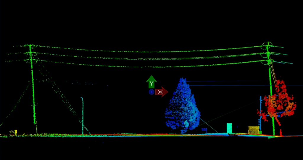
Imagery/LIDAR technology can significantly help electric utilities in several key areas:
Grid Infrastructure Mapping and Planning
- LIDAR provides highly accurate 3D mapping of terrain, vegetation, and existing infrastructure, allowing utilities to create precise digital models of their transmission and distribution networks
- Utilities can use these detailed maps to plan new grid routes, identify potential line expansions, and optimize infrastructure placement with unprecedented accuracy.
Vegetation Management
- LIDAR can detect vegetation encroachment near power lines with millimeter-level precision
- Utilities can create detailed vegetation height and density maps to:
- Predict potential interference risks.
- Plan targeted pruning and maintenance.
- Reduce the likelihood of power outages caused by tree-related incidents.
- Optimize vegetation management budgets by focusing efforts on high-risk areas.
Asset Inspection and Maintenance
- Drone-mounted or helicopter-mounted LIDAR can rapidly inspect transmission lines, towers, and substations.
- Provides detailed 3D imagery to identify:
- Structural damage
- Corrosion
- Mechanical wear
- Potential safety hazards
- Enables predictive maintenance strategies, reducing downtime and repair costs
Right-of-Way Management
- Helps utilities monitor and manage the land around transmission corridors
- Tracks change in vegetation, terrain, and potential encroachments.
- Supports compliance with safety regulations and easement requirements
Climate Resilience and Risk Assessment
- Creates detailed topographical models to assess:
- Flood risks
- Landslide potential
- Storm damage vulnerabilities
- Helps utilities develop more robust infrastructure planning and disaster response strategies
Renewable Energy Site Selection
- Assists in identifying optimal locations for solar and wind installations
- Provides precise terrain and elevation data to maximize energy generation potential
- It helps assess potential shading, wind patterns, and infrastructure connectivity
Environmental Compliance
- Supports environmental impact assessments
- Helps track ecological changes around utility infrastructure
- Assists in minimizing environmental disruption during grid development and maintenance
Electric utilities can leverage LIDAR technology to enhance operational efficiency, improve safety, reduce maintenance costs, and develop more resilient and intelligent grid infrastructure.
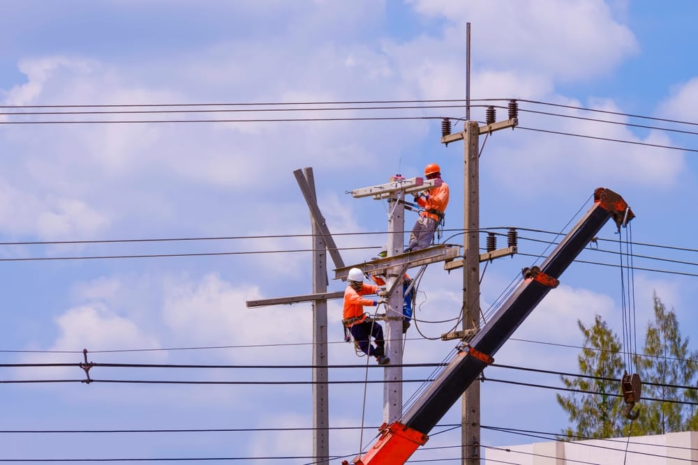
Why 4D?
In mathematics and physics, 4D refers to a space with four dimensions. This concept extends the familiar three-dimensional space by adding a fourth dimension – time.

nfoldROI Imagery and Light Detection and Ranging (LIDAR) customers use 4D Geographic Information System (GIS) epochs to monitor change, for example electricity distribution network vegetation growth near power lines.
Consulting
Consulting is a broad field that involves providing expert advice to organizations to help them improve their performance, solve problems, and achieve their goals.
nfoldROI has 30 years of global experience in Utility, Telco and Government geospatial Information Technology (IT) consulting.
Project Management
Project management involves planning, organizing, and managing resources to achieve specific goals within a defined timeline.
We have a strong track record of managing major Data Services Projects for Tier 1 North American utilities and telcos.
Best-of-Breed Partnering
Best-of-breed partnering involves selecting the best possible solutions from different vendors to meet specific business needs. This approach allows organizations to leverage the strengths of various specialized providers rather than relying on a single vendor for all their needs.
- Our LIDAR technology partners maintain the largest high-definition (HD) mapping mobile fleet in North America and capture 2 million measurements per second, extracting 3D point clouds with centimetre accuracy. They are ready when you are.
- We use their leading Artificial Intelligence (AI) technology to extract features from Imagery through Machine Learning (ML) object detection and image segmentation models.
- Our LIDAR technology partners capture 2 million measurements per second and extract 3D features with centimetre accuracy including tree species recognition stored in a 4D model for epoch comparisons.
- We use advanced partner LIDAR 3D feature extraction and attribution entirely done by AI – including tree species to determine growth rates – at industry-best ~10km2/hour of post-processing time.
- Data are provided to our customers in a Cloud Platform 4D model for visualisation, epoch comparisons, and GIS download as well as QA/QC using our wholly owned Right-Shoring subsidiary to ensure quality, low-cost, and secure data processing.
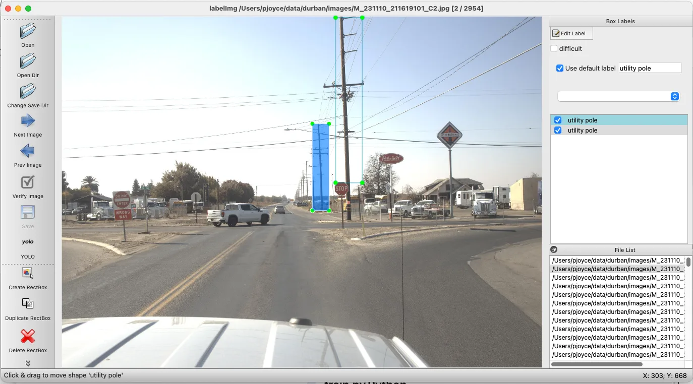
AI Machine Learning Image Classification and Feature Extraction
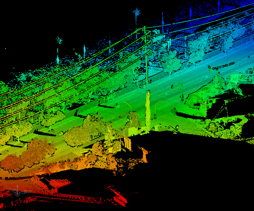
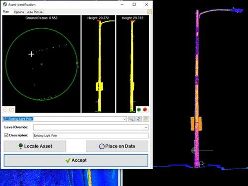
LIDAR Extraction
Imagery & LIDAR Services Tailored for Utilities, DOTs and Municipalities
Processing LIDAR data involves several key steps to transform raw point cloud data into useful information:
Data Collection
LIDAR data is collected using laser scanners mounted on platforms such as drones, aeroplanes, or ground vehicles. The scanners emit laser pulses and measure the time it takes for the pulses to return after hitting an object, creating a 3D point cloud of the environment.
Data Preprocessing
This step involves organizing the raw data and removing noise and outliers. Various factors, including atmospheric conditions and sensor errors, can cause noise.
Georeferencing
The point cloud data is aligned with geographic coordinates using GPS and IMU (Inertial Measurement Unit) data, ensuring that it accurately represents the real-world location.
Point Cloud Filtering
Unwanted points are removed, such as those caused by reflections or atmospheric interference. This step helps in cleaning the data for further processing.
Point Cloud Classification
Points in the cloud are classified into different categories, such as ground, vegetation, buildings, and water. This classification is essential for creating accurate models and analyses.
Surface Modeling
The classified point cloud is used to create various surface models, such as a Digital Elevation Model (DEM) representing the bare ground surface without any objects like trees or buildings or a Digital Surface Model (DSM) including all objects on the surface, such as buildings and vegetation.
Feature Extraction
Specific features such as buildings, roads, and power lines are extracted from the point cloud data. This step is crucial for applications like urban planning and infrastructure management.
Visualization and Analysis
The processed data is visualized using specialized software to create 3D models and maps. Analysis can include measuring distances, calculating volumes, and assessing changes over time.
Data Export
The final processed data is exported in various formats for Geographic Information Systems (GIS), Computer-Aided Design (CAD), and other applications.
These steps ensure that the raw LIDAR data is transformed into accurate and helpful information for various applications.
At nfoldROI, we deliver advanced AI-driven Imagery and LIDAR solutions that empower utilities, Departments of Transportation (DOT) and Municipalities to modernize infrastructure management, optimize operations, and enhance safety and reliability.
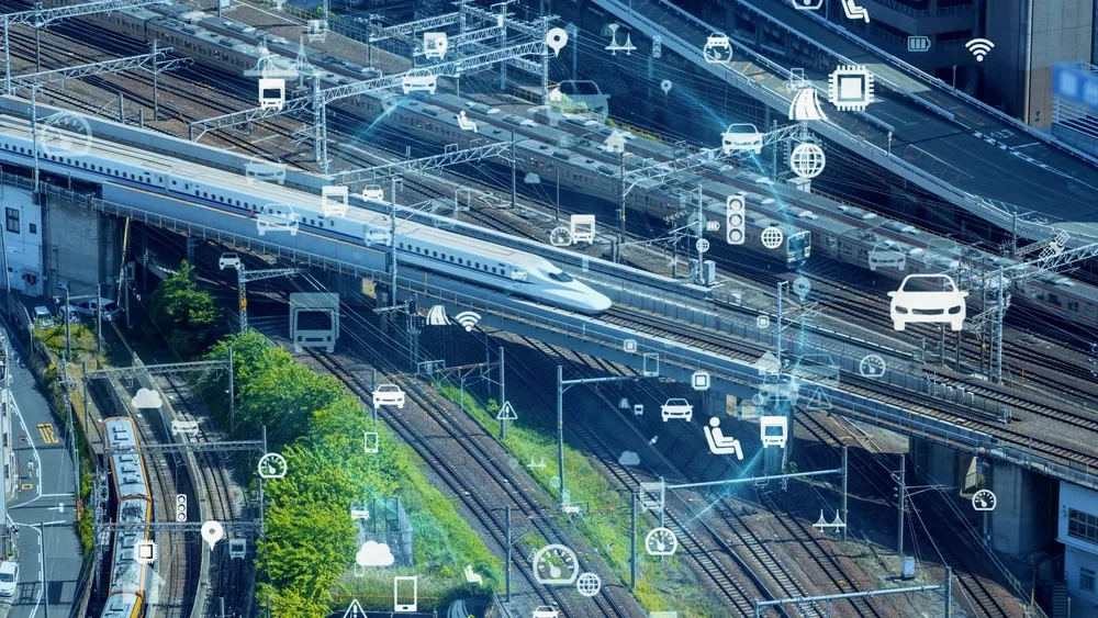
By integrating cutting-edge AI and ML algorithms, our services provide actionable insights that reduce costs, improve efficiency, and support strategic decision-making.
Our LIDAR solutions offer unparalleled accuracy in capturing 3D spatial data, now enhanced with AI-powered feature extraction and classification capabilities.
From high-voltage power lines to transportation assets to municipal street furniture, we use ML algorithms to identify and classify features such as:
- Utility poles, conductors, and vegetation encroachments
- Road signs, lane markings, and surface anomalies
- Infrastructure at risk due to aging or environmental factors
By automating the feature extraction process, we accelerate project timelines and ensure consistent, high-quality results for Utilities, DOTs and Municipalities.