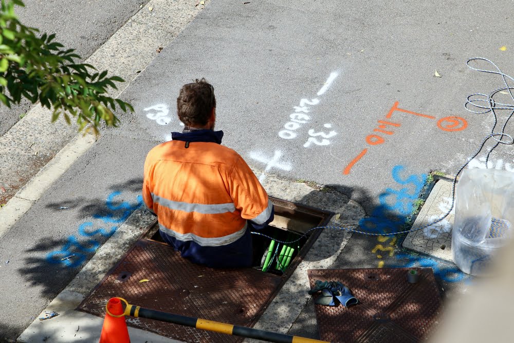
811 is the national “call before you dig” phone number in the United States. If you’re planning any digging projects, such as planting trees, installing fences, or any other excavation work, call 811 a few business days before you start. This service helps prevent accidental damage to underground utility lines by marking their approximate locations with paint or flags.
Here’s a quick overview of the process:
- Call 811: Provide details about your project and location.
- Wait for Marking: Utility companies will mark the locations of underground lines.
- Dig Safely: Once the lines are marked, proceed with your project, being careful around the marked areas.
- This service is crucial for safety and to avoid disruptions to utility services.
[Source: Call 811 – Know what’s below. Call before you dig.]

Services like the 811 in the USA are implemented in many other countries, such as Home | Before You Dig Australia (BYDA). They all work differently due to data sources, compilation, and process flow. The data sources typically used are detailed “as-built” construction drawings showing dimensions that can be used to locate underground features.
Many commercial Augmented Reality (AR) offerings on the market promise to revolutionise the mapping and management of underground utilities. AR allows workers to see a visual overlay of underground utilities on their devices, providing a clear and accurate representation of pipes, cables, and other infrastructure beneath the surface …

… but only if their GIS is a spatially accurate Digital Twin of the Real World and their GPS does the required (differential) corrections to be accurate enough.
Most customer’s GIS do not meet this criterion, and their asset locations could be hundreds of feet off their true position. Our global #utility and #telco customers experience large irregular displacements (up to 800 feet) between the land base and utility network in their legacy GIS and “real world” measurements.
In recent years, there has been a revolution in #imagery and #LIDAR technology. We can now map the Real World at +/- 1″ using Total Stations, #GPS, Aerial Imagery, and LIDAR – all basically “too accurate” to match most Utility #Network legacy GIS.
An #inhomogeneous Shift Model between legacy GIS and the Real World is required. Adjust.IT is the #1 Conflation Methodology in the World and includes # pattern recognition, advanced #raster to #vector #conversion, US #Patent pending #AI correlation, rigorous least squares adjustment, sparse matrix algebra, Natural Neighbourhood Interpolation, and extensive statistical analysis and visualisation capabilities.

adjust.IT solves linear equation systems at the rate of 250,000 unknowns (dX, dY) per second on a low-cost PC and allows for the #spatial #accuracy improvement of legacy GIS from hundreds of feet to one inch, producing an accurate Real-World GIS Digital Twin. It is available on #Smallworld GIS, #ArcFM, #ArcGIS Pro, ArcGIS Online, and ArcGIS Utility Network as a Conflation-as-a-Service (CAAS).
The #business #benefits of adjust.IT are compelling:
- GIS users can trust data #spatial #accuracy, which is crucial for #811 call-before-you-dig applications (https://call811.com )
- Land base management costs are significantly reduced.
- Emergency services can precisely overlay their GIS data.
- Improved GIS spatial accuracy means better #analytics, #decision making and operational #savings in a #Digital #Enterprise.
If you are interested in finding out more about the #1 Utility Network Conflation solution, adjust.IT, or if you are ready for a Proof-of-Concept project …
- Contact Us (on this page)
- in the US & Canada call 1-888-NFOLDROI (1-888-6365-376), or
- email us at avatar@nfoldROI.com
and we will get back to you ASAP.
#nfoldROI is a global leader in #Digital #Transformation, operating in North America, Australia, India, New Zealand, the UK, and Germany. We specialise in high-quality, low-cost, secure #Rightshoring #Conflation and #Data Services. We are # ISO9001 and # ISO27001 certified and have a 30-year delivery track record of exceeding the expectations of our customers and partners.
In North America, our proprietary #adjust.IT software has been licensed to 25 of the largest utilities and telcos, and our wholly-owned Rightshoring subsidiaries in Australia and India have performed the work.
We have adjusted one million land #parcels in New Zealand, 80% of populated Australia, France, and large parts of the USA and Canada, including New York City and all of Texas. We have adjusted 11 million miles of #Electricity, #Gas, #Water and #Telco #networks, 42 million Customer #Supply Points and more than 400 million GIS #coordinates, worldwide